Austria
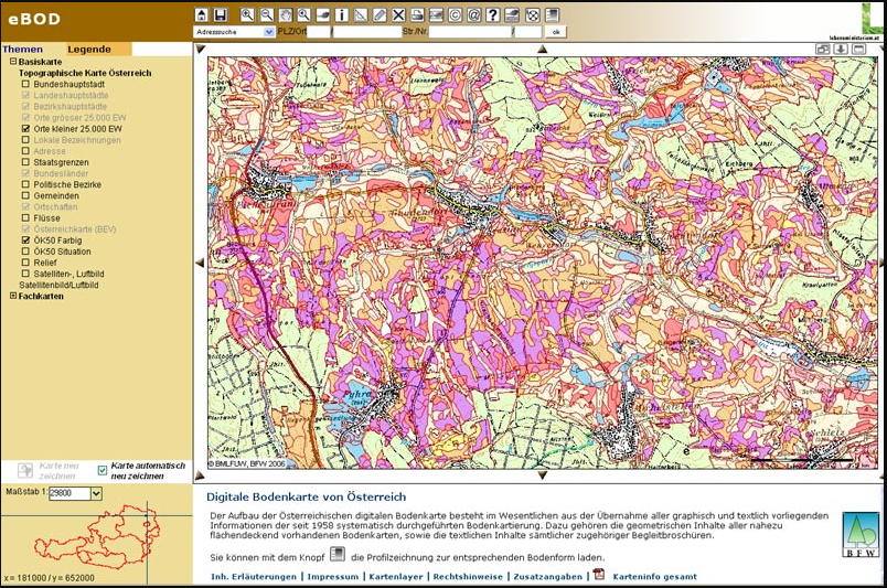
The eBOD web GIS application is the internet version of the digital soil map and allows users to access all location properties of agriculturally usable and mapped soils in Germany free of charge and without complications. No additional installation or registration is required.
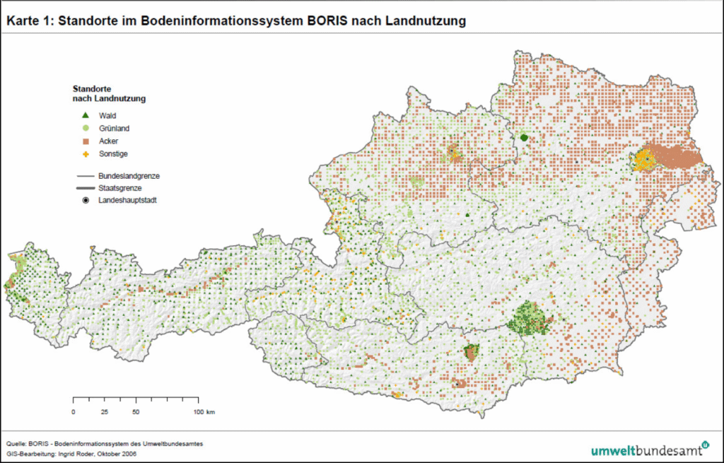
The national soil information system BORIS contains data on diffuse soil contamination regarding inorganic and organic pollutants. Country wide metal concentrations in topsoil are presented in BORIS soil map service as separate map sheets (PDF´s) for each mapped element. For the dataset, the public data query (BORIS-PUBLIC) only provides information on the availability of analysis values, but not the actual values. Larger datasets and analysis values can be requested from the Federal Environment Agency.
France
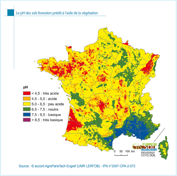
GIS Sol’s work is conducted around four major complementary programmes: the Soil Inventory, Management and Conservation (IGCS), the Soil Quality Measurement Network (RMQS), the Soil Analysis Database (BDAT) and the national collection of trace metal analysis data (BDETM).
Germany (Bavaria)
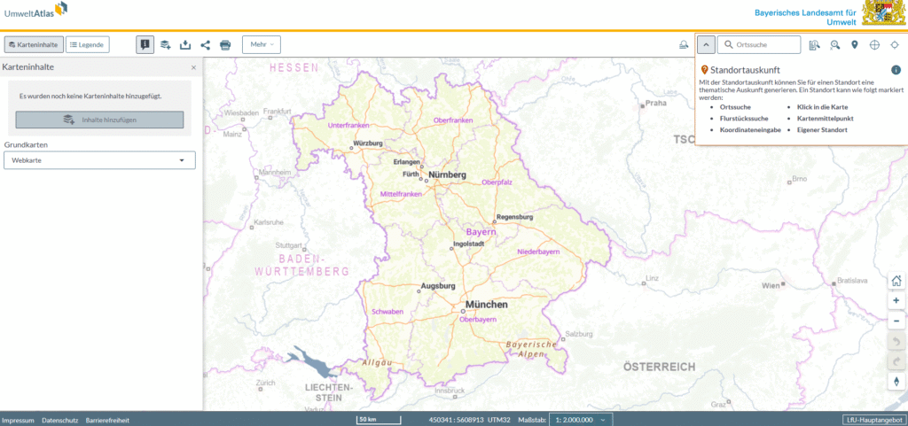
The Bavarian Environmental Atlas provides citizens, local authorities and businesses with spatial environmental data in an innovative web application. In addition to covering a wide range of topics, the Bavarian Environmental Atlas offers a very broad spectrum of functionalities as well as intuitive operation and design. The Bavarian Environmental Atlas can also be used on mobile devices.
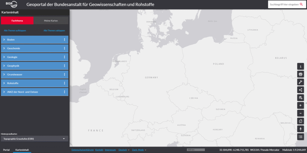
Welcome to the BGR geoportal. Select a topic or search term to get started – www.bgr.bund.de. The Geoviewer allows you to display data on various topics.
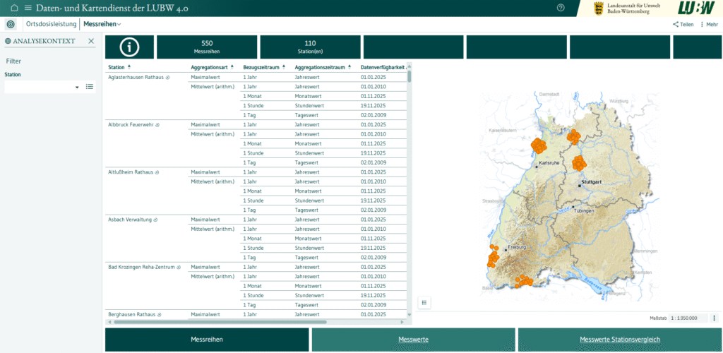
The LUBW 4.0 data and map service provides interactive access to freely available environmental data and digital data sets. The data originates from LUBW measurement and investigation programmes and from the information network of municipal and state environmental agencies in the state of Baden-Württemberg.
With its data and map service, LUBW comprehensively fulfils the obligations of the Environmental Administration Act (UVwG) of 1 January 2015.
Slovenia
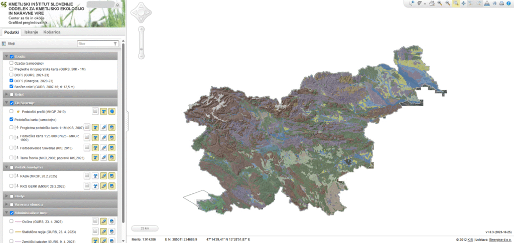
The eTLA portal provides online access to interpreted soil data and soil-related data that are important for agricultural production, environmental protection, and natural resources.
At the center, we strive to consolidate, organize, harmonize, and standardize soil data obtained with public funds and, above all, to provide access to it. All too often, this data remains uncoordinated, scattered across different institutions/project implementers, and is therefore less accessible or not used at all. The purpose of the center’s website is to increase the accessibility and utilization of data according to the principle of “interpreted and public soil data in one place.”